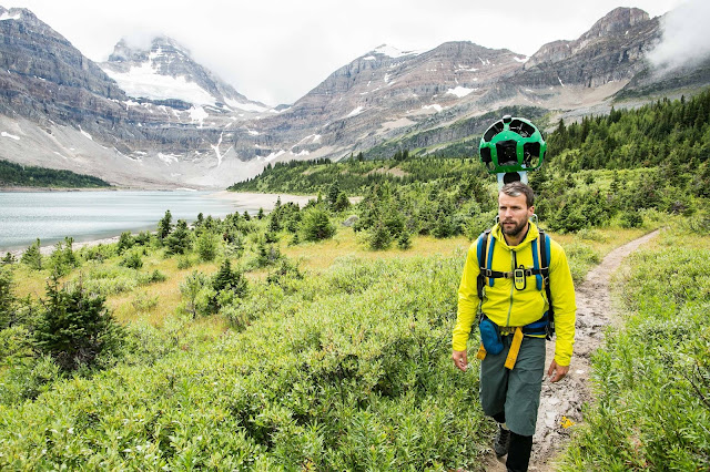
British Columbia Canada is getting put on the map, literally. Through a partnership with Google, stunning imagery from British Columbia’s wild places has been added to Google Maps, complemented with interviews with BC locals, imagery, drone footage, immersive 360° video, and featured businesses on the new BC Journeys platform www.bcexplorer.com/journeys.
Using Google Street View, people from around the globe can now virtually hike in some of the province’s vast wilderness and be inspired by the powerful nature they see around them.
British Columbia joins a select group of bucket-list Google Street View Trekker destinations such as the Pyramids of Giza, the Grand Canyon and the Galapagos Islands.
There are currently 176 new British Columbia Google Street View Treks now featured on Google Maps, with 14 more to be uploaded by Google. Here is a sample of the Treks:
Sunshine Coast Trail
Kettle Valley Trail (Myra Canyon)
Blackcomb Mountain (Decker Loop)
Lake Magog (Assiniboine Lodge)
108 Lake Accessible Trail
Anthony Island, Gwaii Haanas
Bridge Glacier
Pacific Rim (Schooner Cove Trail)
Windfall Lake (near Tumbler Ridge)
Find treks in British Columbia by reviewing the BC Explorer platform http://www.bcexplorer.com/journeys or through Google Maps, by searching for BC’s Google Street View Treks.
Quotes:
Marsha Walden, CEO, Destination BC
“There are over one billion monthly users of Google Maps. Through these Treks and our new interactive platform, BC Journeys, we can give people a window into our wilderness like never before – creating a connection before people even leave their homes. Combining this powerful, immersive video footage with compelling, authentic stories creates an augmented reality experience that is a pretty potent recipe for driving visitation.”
Nicole Bell, Google Street View Trekker Expert
“We’re incredibly proud to partner with Destination British Columbia in this Trekker project. We’ve worked together for years to bring the world to British Columbia and bring British Columbia to the world. These new Street View images, especially some of the more remote locations in BC, are an important part of Google’s goal to create the world’s most comprehensive, accurate and usable map. More than one billion people around the world use Google Maps every month, and we are thrilled to share some of British Columbia's iconic landscapes.”
Here’s how you can see BC’s Street View Treks:
- Search for a place in Google Maps. Drag the yellow ‘Pegman’ to a place on the map.
- The blue areas on the map show where Google has collected ‘Street View’ content.
- To move around, hover your cursor in the direction you want to go. Your cursor becomes an arrow that shows which direction you're moving. To see where you might go next, look for the “X”; click once to travel to the “X”. To look around, click and drag your mouse. You can also use the arrows to the left and right of the compass.


